Harnessing the Power of Sentinel-1 Radar Satellites for Accurate Imagery and Elevation Data
Leverage radar imagery and derived elevation data for large scale, cloud free geospatial analysis
2/6/20252 min read


Introduction to Sentinel-1 Radar Satellites
Sentinel-1 radar satellites play a crucial role in providing timely and cloud-free global synthetic aperture radar (SAR) imagery. These satellites, part of the European Space Agency's Copernicus program, are equipped with advanced radar technology that ensures the acquisition of high-resolution imaging, making them invaluable for various applications.
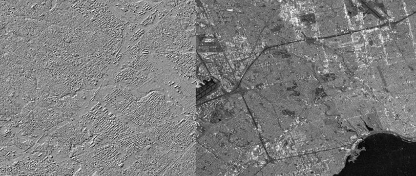
Elevation model (left) and Radar Image (right) of Toronto, Canada created from Sentinel-1 radar imagery
Significance of Cloud-Free Imagery
One of the standout features of Sentinel-1 satellites is their ability to acquire imagery without the interference of weather conditions. Traditional optical imaging techniques often face challenges posed by clouds, limiting the frequency and reliability of data collection.
However, with radar imagery, data can be gathered under any weather condition, thus allowing for consistent monitoring of the Earth's surface. This capability is essential for both environmental monitoring and disaster management.
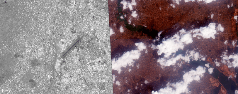
As shown below radar images provide a clear and comprehensive view of the ground unobstructed by clouds. The image differs in it's appearance but Sentinel-1 provides comprehensive coverage every 12 days while optical image mosaics in some regions may take years to completed from satellite.


Radar Image (left) compared to cloudy optical Image (right) of Benin City, Nigeria
Combining Images for Accurate Elevation Data
Over time, the images captured by Sentinel-1 can be combined using Interferometric Synthetic Aperture Radar (InSAR) techniques to derive precise elevation data. By analyzing the changes in phase between multiple radar images, it is possible to calculate the elevation differences with remarkable accuracy. This process not only aids in topographical mapping but also facilitates the monitoring of ground deformation, landslides, and other geophysical phenomena.
The integration of InSAR techniques with the extensive imagery capabilities of Sentinel-1 enhances our understanding of the Earth's surface dynamics. The data generated from this combination can support numerous sectors, including urban planning, geotechnical engineering, and climate change studies.

Learn more about Sentinel-1 from ESA
Conclusion
In conclusion, Sentinel-1 radar satellites are a vital resource for obtaining timely, cloud-free SAR imagery. Their ability to provide continuous data over time allows for the effective use of InSAR techniques to generate accurate elevation data. As technology continues to evolve, the utilization of these satellites will become increasingly important for a wide array of scientific and practical applications.
