Protecting the Democratic Republic of the Congo's Rich Biodiversity Amidst Mining Expansion
Identifying changes to large and small scale mining operations using current large scale elevation data created from the Sentinel-1 satellite constellation
1/29/20255 min read


Introduction to Cobalt Mining in the DRC
The Democratic Republic of the Congo (DRC) stands as the world's largest supplier of Cobalt, a critical mineral necessary for the swift transition towards electric vehicles. This remarkable mineral is not only essential for producing batteries but also plays a pivotal role in the fight against climate change. As the global demand for electric vehicles surges, the DRC's significance in the cobalt market intensifies.
Expansion of Mining Operations in the DRC
In recent years, the DRC has witnessed a striking expansion of both commercial and small-scale (artisanal) mining operations, particularly in the eastern regions of the country. These expansions are not only notable for their geographical footprint but also for the rapid pace at which they are occurring. While the economic benefits of such expansions can be substantial, it is crucial to acknowledge the potential environmental and social impacts that accompany them. Mapping of expansions of existing and new mines can be accomplished effectively using satellite monitoring with the Sentinel-1 SAR constellation.
The Need for Responsible Mining Practices
As the DRC's mining operations grow, it becomes imperative to safeguard the nation's unique geographic and biological diversity. The DRC is home to some of the world's most diverse ecosystems, including vast rainforests and an array of wildlife that depend on these habitats. Consequently, it is essential that both Congolese and multinational mining companies adhere to responsible mining and reclamation processes.
Implementing sustainable practices in mining is critical not only for the protection of biodiversity but also for ensuring that local communities can thrive. Effective reclamation efforts can restore the land post-mining and mitigate the long-term impacts on the environment. Furthermore, engaging local communities in such initiatives fosters a sense of ownership and responsibility towards the natural resources that sustain their livelihoods.
As the Democratic Republic of the Congo continues to be a vital player in the cobalt supply chain, the balance between economic development and environmental preservation must be maintained. The expansion of mining sites must be accompanied by an unwavering commitment to responsible practices that protect the DRC's unique biodiversity now and in the future.
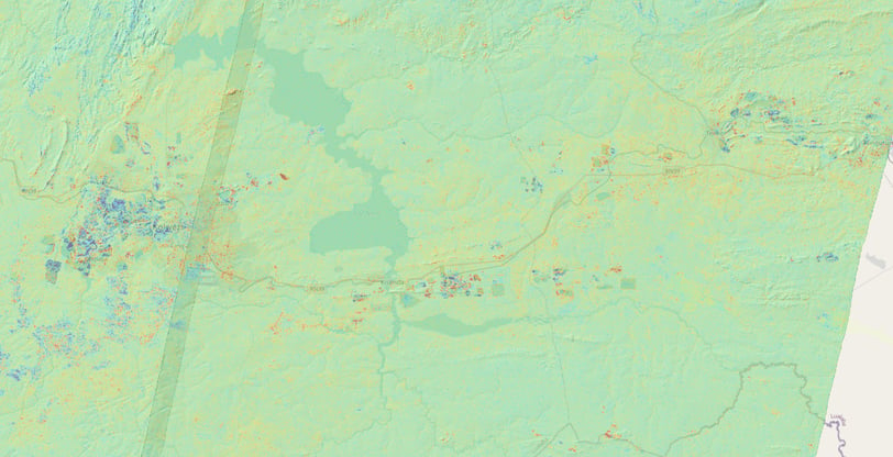


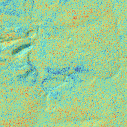
The figure above illustrates regions where the ground has been lowered (blue) and raised (red) over the four year period.
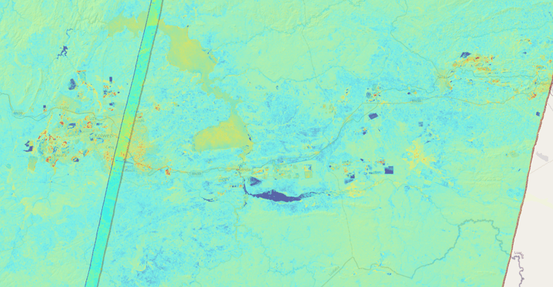
The figure above indicates regions where the land use has changed including mining activity, new buildings and significantly more water in 2024 than 2019.
Monitoring Mine Expansion
Change Geo provides the means to monitor mining activity, expansion and reclamation processes using frequently acquired satellite data captured by the Sentinel-1 radar satellite constellation. SAR's unique ability to capture cloud free datasets every 12 days over the expanse of the DRC enables very precise change detection to land use.
Measuring changes in the SAR imagery and using InSAR techniques to measure changes in elevation allows for the ongoing geolocation and estimation of the impact of mining activity and associated land use changes including both habitat loss and reclamation if sustainable mining practices are adhered to.
The province Lualaba in the south of the DRC is known as the "Copper Belt" of central Africa. Cobalt is a common byproduct of Copper mines and has been experiencing tremendous growth over the last decade.
The following images display the extensive changes to existing as well as the addition of new mining operations between the cities of Kolwezi (west) and Fungurume 100km to the east between the years 2019 and 2024.
Active Mine Assessment
Mine activity including changes to its depth, extents and neighboring communities can be assessed to a resolution of 14m.
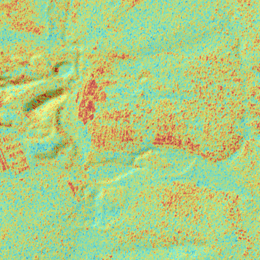
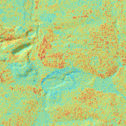
The following images display the difference in radar imagery and elevations derived from InSAR processing from 2019 and 2024. New mines covering approximately 85 km² have been added in the top and bottom right of the images.
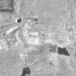
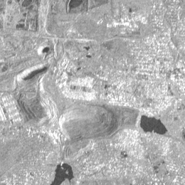
SAR Imagery alone provides a good measure of changes where the climate has not varied significantly. Very Dark regions in radar imagery indicate water while in vegetation can indicate more moisture by changing in the radar cross-section making the pixels darker. Bright regions within the image indicate strong reflectance of the radar and are characteristic of manmade structures.
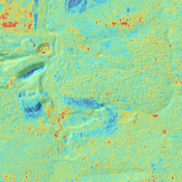
Employing repeat pass interferometry (InSAR) on a series of SAR images allow measurement of elevation changes locally. While more susceptible than SAR imagery to atmospheric effects valuable information can be extracted which is more consistent at determining geomorphic changes over regions which can be useful in determining the addition of infrastructure and estimating mining activity as well.
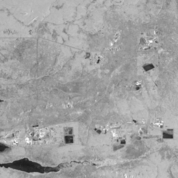
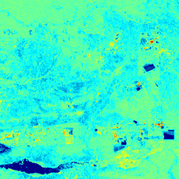
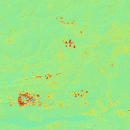
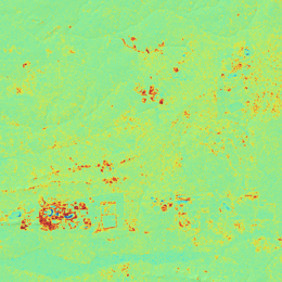
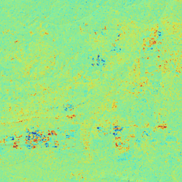
Figure 1. Elevation changes (2019), Figure 2. Elevation changes (2024), Figure 3. Elevation Differences (2024 - 2019)
Identify New Mines
The rapid addition of new mines requires ongoing map updates. In addition to the mine itself supporting infrastructure for processing, housing and waste is required.
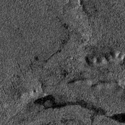
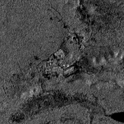
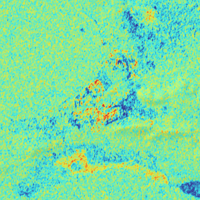
Displayed below is one of many new mines being developed on the southern border of Lualaba.
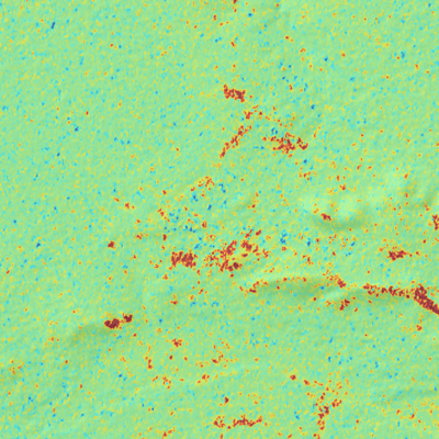
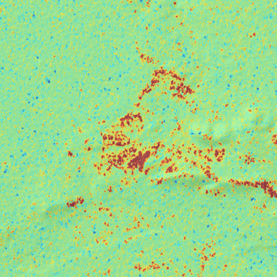
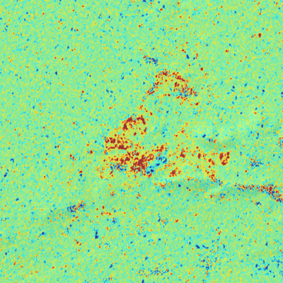
Population Displacement
The city of Kolwezi is a mining town with a population of over a half million residents. As mining operations expand portions of the city are absorbed. The mined area at the center of the image expanded north eliminating a large portion of the Quarter Six Maisons neighborhood and can be observed in both the SAR image and the elevation data.
1
2
3
Figure 1. SAR Image Composite (2019), Figure 2. SAR Image Composite (2024), Figure 3. Difference Image (2024 - 2019)
1
2
3
1
2
3
1
2
3
Figure 1. SAR Image Composite (2019), Figure 2. SAR Image Composite (2024), Figure 3. Difference Image (2024 - 2019)
Figure 1. Elevation changes (2019), Figure 2. Elevation changes (2024), Figure 3. Elevation Differences (2024 - 2019)
Figure 1. Elevation changes (2019), Figure 2. Elevation changes (2024), Figure 3. Elevation Differences (2024 - 2019)
1
2
3
2
1
3
Figure 1. SAR Image Composite (2019), Figure 2. SAR Image Composite (2024), Figure 3. Difference Image (2024 - 2019)
From Boom to Bust
The Democratic Republic of the Congo (DRC) is experiencing a significant mining boom, reminiscent of historical mining surges seen elsewhere. This explosive growth in the sector presents tremendous wealth and opportunities, not only for the local economy but also for global markets seeking valuable resources. The potential for economic transformation is immense, as the mining industry can play a pivotal role in supporting infrastructure development, providing jobs, and enhancing living standards. However, it is also crucial to ensure that this wealth is harnessed responsibly, benefiting the communities that are often impacted by mining activities. The DRC stands at a crossroads, where strategic planning and sustainable practices can aid in the transition from mere resource extraction to a holistic economic upliftment that fosters long-term prosperity for all stakeholders involved.
