
Advancements in Elevation Measurement Utilizing Repeat Pass Radar Interferometry
5/20/20254 min read
Introduction to Sentinel-1 and InSAR Techniques
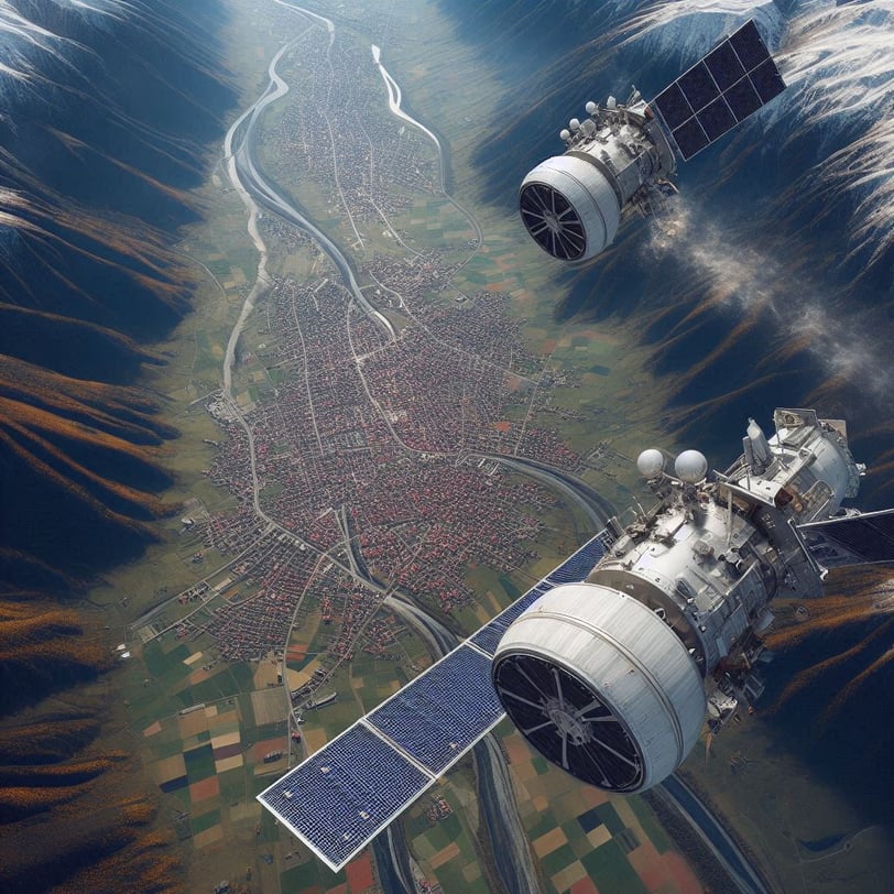
Sentinel-1 represents a significant advancement in satellite radar technology, playing a crucial role in Earth observation and surface monitoring. As part of the European Space Agency's Copernicus program, Sentinel-1 consists of a constellation of satellites equipped with Synthetic Aperture Radar (SAR). These satellites operate independently of weather conditions and daylight, enabling consistent monitoring of the Earth's surface. The primary goal of Sentinel-1 is to provide timely data for land use mapping, change detection, and infrastructure analysis.
One of the key methods utilized by Sentinel-1 involves the application of Interferometric Synthetic Aperture Radar (InSAR) techniques. InSAR employs two or more radar images captured from slightly different positions to measure surface changes with high precision. By analyzing the phase difference between these radar signals, scientists can detect variations in elevation and other surface deformations. These techniques are particularly adept at measuring small subtle changes over time, making them invaluable for infrastructure monitoring and assessment.
The distance between the imaging positions, referred to as the perpendicular baseline has a dramatic effect what is observed. A short perpendicular baseline (< 50 meters) is used for surface deformation monitoring, while a larger perpendicular baseline (500 meters) is ideal for measuring elevations to create Digital Surface Models (DSMs) which describe terrain, buildings and other features.
Sentinel-1 is designed to maintain a short perpendicular baseline with the intention of accurately monitoring land subsidence, structural integrity of buildings and bridges, and the impact of natural disasters, such as earthquakes and landslides.
Change Geo has created an InSAR processor that is capable of measuring height of terrestrial features such as buildings, mines and roadways to create DEMs using the short perpendicular baseline of Sentinel-1.
Sentinel-1 and InSAR techniques used by Change Geo provide innovative solutions for infrastructure analysis and change detection over large areas at requested timeframes an high resolution horizontally and vertically.
Read on to learn how we process radar image pairs to create surface models over prescribed time frames using Sentinel-1.
Understanding Repeat Pass Interferometry
Repeat pass interferometry is a sophisticated technique employed in the analysis of radar images acquired from satellite platforms, particularly in the context of elevation measurement. This method relies on the acquisition of multiple radar images of the same geographical area taken at different times, allowing Change Geo to examine temporal changes in surface elevation with high precision. The essence of this technique lies in the use of phase difference between the radar signals emitted by the satellite during successive passes over a specific site.
In a typical repeat pass interferometry setup, two synthetic aperture radar (SAR) images are captured. The first image serves as a reference, while the second image is collected after a certain time interval referred to as the temporal baseline. This interval can vary, depending on the specific application and conditions of the environment.
InSAR uses radar's coherence to measure detailed changes on the ground by creating an interferogram. If there is a difference in satellite locations can be leveraged to measure elevation models while if the imagery is captured from the same location, but a different times of the ground is measured.
The methodology involves several crucial steps. Firstly, the images must be pre-processed to correct for various distortions, including atmospheric effects and orbital discrepancies. Once the preprocessing is complete, the phase difference is computed.
The phase difference must then be unwrapped to allow and converted into elevation change measurements based on the distance between the two satellite positions where from each other when the images where captured. This is referred to as the Perpendicular Baseline.
For a very detailed review of the considerations and approaches NASA has an excellent explanation pertaining to bi-static and repeat pass interferometry here.
InSAR Process
The following illustrates the process Change Geo uses to process InSAR data leveraging ESA's SNAP toolbox and Change Geo's Phase Unwrapping
The Importance of Pixel Resolution in Elevation Measurement
In the realm of elevation measurement, particularly through satellite imagery, pixel resolution plays a crucial role in determining the accuracy and reliability of the data collected. Achieving a pixel resolution of 14 meters is particularly significant, as it offers a level of detail that can greatly enhance assessments of surface changes to approximately the size of a building.
The ability to analyze elevation changes with a resolution of 14 meters translates into informed decision-making and proactive measures.
In essence, pixel resolution is not merely a technical specification but a pivotal element that significantly influences the quality and utility of elevation measurement. As we continue to harness and refine these advancements, the implications for infrastructure management become clearer, underscoring the relevance of high-resolution data in shaping a resilient and sustainable environment.
Challenges Faced in Radar Imaging and Data Analysis
The utilization of Sentinel-1 radar image pairs for elevation measurement and infrastructure analysis brings with it a series of challenges, primarily stemming from noise levels. One significant issue arises from the small perpendicular baseline that is characteristic of Sentinel-1. This small baseline can lead to an increased sensitivity to environmental noise and other interferences, which may result in inaccuracies in the measurements. The impact of noise is exacerbated when one considers the large temporal baseline associated with the satellite's imaging capabilities. Temporal baselines refer to the time interval between two radar images, and a larger gap can introduce variations in ground displacement that complicate the analysis. Such discrepancies affect the accuracy of the data and pose significant challenges when interpreting the associated elevation changes.
Change Geo has developed processes to account for the reduced perpendicular baseline and increased temporal baseline of Sentinel-1 allowing it to create accurate 3D height models over customer defined timeframes and locations.
Global Scale Analysis of Surface Changes
The utilization of Sentinel-1 radar image pairs offers a significant advantage in the global-scale analysis of surface changes, particularly in the context of infrastructure management and disaster response. Sentinel-1, part of the European Space Agency's Copernicus Programme, equips analysts with the ability to monitor and assess landscape alterations with high temporal frequency. This capability is particularly valuable when evaluating infrastructure changes over user-defined timeframes, such as determining localized changes to land use and updated analytics.
One of the primary benefits of employing radar imagery is its effectiveness across diverse environmental conditions. Unlike optical sensors that may be hindered by cloud cover or atmospheric disturbances, radar systems can capture data regardless of weather conditions or daylight availability.
Furthermore, the inherent features of radar imaging, such as interference patterns and surface deformation analysis, allow for precise detection calculation of ground heights in mines, buildings and other man-made structures.
In an era defined by rapid urbanization and climate variability, investing in advanced technologies like Sentinel-1 radar imagery is imperative for the future of global infrastructure analysis and management.